 Uncanny Content TheKDBlog No 1 Technology Blog helps you live a dream life with blogging. TheKDblog help to tech lover provide Tech News, Bike, Movie, share, Blogging, etc
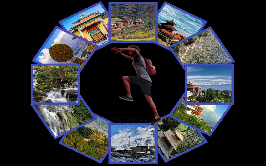
Best Short Hikes Around Kathmandu Valley: There are many routes suitable for hiking around Kathmandu Valley every season. A day trip i.e. hiking or short hiking around Kathmandu. Hiking in the morning and coming home in the evening is also called a short hike or one-day hike. Many people asked me about hiking places around Kathmandu. Hiking is popular today among those who seek to refresh both body and mind from the stresses of a busy lifestyle. There are many hiking trails around the Kathmandu Valley, where you can leave the city in the morning and return home in the evening.
Shivpuri, Nagarjuna, Gokarna, Sundarijal, Tarebhir, Jhor, Pharping, Champadevi, Chandragiri, Bungamati, Godavari, Phulchoki, Lankuribhanjyang, Sanga, Changunarayan, Panauti, Namobuddha, Nagarkot, Sankhu, Balthali, Gundu, Kakani. These hiking trails are considered special for forest, bird and plant lovers.
Every Saturday, young people go to the hills around Kathmandu Valley to refresh their bodies and mind. One day hiking for physical exercise and fun is also beneficial from a health point of view.
Destination selection
When choosing a hiking destination, choose a new but safer place. Everyone’s interest should be taken into consideration in group hiking. Considering security and potential problems, it is best to go in groups of at least 10 people. One hike may not fulfill the desire to see mountains, nature, religious-cultural sites, flora, fauna, and birds.
Therefore, the hiking route should be chosen by gathering as much information as possible. Travel is fun and exciting if the destination is suitable. This is where hiking comes in handy. People choose Kakani hike, Shivapuri hiking, and ChampaDevi hiking for short hikes but there many other hike destination near Kathmandu valley.
Today, the road has reached everywhere. Hiking is better when you choose a trail around the road. Trail and weather preparation should be done in advance. You should take sunglasses, towels, caps, hats, and sun protection cream while hiking. Shoes and clothing should be easy to walk on.
Umbrellas and raincoats are a must in the rainy season. Similarly, drinking water, light food, fruits, first aid kits, maps, sticks, cameras, etc. should be carried. The hiking done with such preparation is definitely memorable.
There are hiking trails in the valley that can be traversed by forests, mountains, nature, religious and cultural sites, flora, fauna and birds. Following are some of these popular destinations
- Shivpuri
Maximum height: 2,563 meters
Hiking distance: 16 to 18 km
Time 5/6 Hours
Shivpuri is a famous hiking trail. Crowds of hikers can be seen during the holidays. There are three trails to reach Shivpuri Danda within the Shivpuri-Nagarjuna National Park north of Kathmandu. After entering the park from the water source of Budhanilkantha, one can reach the hill through the right Bishnudwar, the mouth of Vishnumati or the route on the left. There are two routes to reach Shivpuri from Vagadwar. The hike starts from the water source and reaches the Nagi Gumba. Nagy Gumba is a special destination and there is also a view tower.
After travelling uphill in the dense forest and reaching Shivpuri hill, you can see the view of the mountain range. Hiking in Shivpuri is also considered to be suitable for learning about birds, butterflies and various species of plants. The school also takes its students.
- Phulchoki
Maximum altitude: 2,765 meters
Hiking distance: 18 km
Time 5/6 Hours
Phulchowki is the highest hill in the valley. Fulchowki hiking is not for anyone. Due to this, it is considered a ‘Tough Trail’. Due to the secluded and difficult location, hiking is relatively rare. The hiking trail starts from the Godavari and the same route is used on the way back. There are forests of different species of Sunakhari and Gurans. Phulchowki is also known as a place to go to play snow in winter. From Phulchoki hill, one can see the scenery of Everest, Gaurishankar, Ganesh, Langtang, Manaslu and Annapurna mountain ranges.
- Lankuribhanjyang
Maximum height: 1,977 meters
Hiking distance: 9 km
Time 3/4
All three valley cities can be seen from Lankuri Bhanjyang of Lalitpur. There is a forest of pine, cactus and Ligurians (Rhododendron). It is also suitable for paragliding and watching the sunrise. Trails from Lubhu to Lankuribhanjyang via Suryabinayak and from Dhungin to Lankuribhanjyang and back to Dhungin are more used routes. Raya of Kavre, Kusadevi, Dadhikot of Bhaktapur or Anantalingeshwar is another route. Similarly, Lankuri Bhanjyang can be hiked from the Godavari. All trails are 10 and 15 km.
- Sundarijal
Maximum altitude: 1,280 meters
Hiking distance: 14 km
Time 4/5 Hours
Sundarijal is famous for picnics and sightseeing. In this forested area, you can see waterfalls and play in the water. There is a hiking route from Sundarijal to Okhreni via Mulkharka and from Changunarayan to Sundarijal. You can also go hiking from Sundarijal to Shivpuri or Nagarkot.
Related: 17 Best Dating Spots in Kathmandu
There is also another hiking trail from Mulkharka to Jhule through Chisapani of Sindhupalchowk. For that, one has to stay in Chisapani for one night.
- Champadevi
Maximum altitude: 2,285 m
Hiking distance: 14 km
Time 5/6 Hours
Champadevi hill in the southwest of the valley is the border of Kathmandu and Makwanpur districts. Starting hiking from Toudaha of Chobhar, passing through Dakshinkali temple, one can return from the same trail, looking at the nearby Newar Basti Pharping. From Champadevi, one can see the mountain ranges including Gaurishankar, Langtang and Annapurna. Another route to Champadevi is also from Machhegaun in Kirtipur.
- Nagarjuna
Maximum height: 2,128 m
Hiking distance: 9 km
Time 4/5 Hours
The Nagarjuna Hiking within the Shivpuri-Nagarjuna National Park starts from the flower garden of Balaju Bypass. Nagarjuna is famous for its yoga meditation. This route is located in the northwestern part of the valley. On the hill is the Jamacho Gumba and the view tower. From the hill, one can see Langtang Annapurna, snow-capped mountains and valleys.
- Chandragiri
Maximum altitude: 2,475 m
Hiking distance: 12 km
Time 5/7 Hours
Chandragiri is one of the famous hiking trails. The journey starts from Machhegaun of Kirtipur and reaches Chandragiri through Chhapdanda. At Chandragiri, there is a bunker built by Kalu Pandey during the invasion of the valley, which is now called Kalu Pandey Fortu. Another trail leading to Chandragiri hill is also from Godamchaur in Thankot. From Chandragiri you can see Mount Everest, Makalu, Kanchenjunga, Manaslu and other mountains. Some of them have reached Chitlang of Makwanpur from Godamchaur and spent one-night visiting Indrasarovar.
- Sankhu
Maximum height: 2,366 meters
Hiking distance: 14 km
Time: 5/6 hours
Features: Bajrayogini Temple, Old Newar and Tamang Basti, Agriculture Area, Manichud Lake.
Sankhu is one of the ancient settlements of the Kathmandu Valley. From here, there is a fun hiking route to Manichud via Bajrayogini. New-old settlements, farms, and forests are the features of this route.
Check also: Top 5 Best Sports Shop In Kathmandu Nepal
Hiking can be done on four routes by making Sankhu the starting or ending point of the journey. There is also a route from Changunarayan to Sankhu via Telkot. Similarly, reaching Chisapani and Shivpuri from Manichud is also in Routes.
- Namobuddha
Maximum altitude: 1800 meters
Distance: 12.5 km
Time: 5 and 6 hours
Features: Namobuddha Stupa, Orange Cultivation, Tamang settlement, mountain view.
Hiking can be done from Dhulikhel to Namobuddha, the famous religious site of Kavre. There is another fun trail from Dhulikhel’s Batasedanda to Kavrebhanjyang. There is another trail from Dhapasi of Panauti to Namobuddha. From Namobuddha, one can observe the mountains including Gaurishankar, Langtang, Dorje Lakpa, Ganesh and Manaslu.
- Balthali
Elevation: 1400 meters
Distance: 10 km
Time: 5/6 hours
Features: Newar and Brahmin Village, village trips, four suspension bridges over four rivers and farm observation.
Balthali of Kavre has now become a tourist village. Those who enjoy green and quiet villages go hiking. The journey can be completed from Khopasi to Balthali, Rossi, Ladku Khola and small villages. Long hikers can come to Balthali through Kaverbhanjyang. From Balthali hill, mountains like Sagarmatha, Ganesh, Langtang etc. can be seen. There is the Ladku river under Balthali hill. Inside the nearby cave is the temple of Ladkeshwar Mahadev. All of these can be seen in one hiking.
- Ashapuri Mahadev
Maximum altitude: 2,278 m
Time took: 6/7 hours
Distance: 16 km
Features: Suryavinayak, Pilot Baba Ashram, Newar and Tamang Village.
Pilot Baba Ashram is reached from Gundu of Bhaktapur by observing the pine forest. On this route, you can reach the temple of Ashapuri Mahadev with its natural shade. You can return from Ashapuri Mahadev on the border of the Bhaktapur and Kavre districts. Forest and rural life is other features of this hiking route.
- Dalchowki
Maximum height: 2,165 meters
Time took: 5/6 hours
Distance: 15 km
Features: View of Manakamana Temple, Thanapati Cave, Hetauda, Simara and Kathmandu.
It is said that Prithvi Narayan Shah sent troops from Dalchowki in North Lalitpur to attack the Kathmandu Valley. Now, the practice of hiking from Birkhedhara to Manakamana Temple, Thanapati Cave to Dalchowki Danda has increased. Dalchowki hike is very suitable for panoramic views of the mountain range and the plains. Another way to reach Dalchowki is from Tikabhairav.
- Tarkeshwar Mahadev
Maximum altitude: 1,800 meters
Time took: 5/6 hours
Distance: 15 km
Features: Bhubaneswari Temple, Panch Mane, Osho Tapovan, view of Nuwakot, Jhor Jharna.
The hike to the Tarkeshwar Mahadev Temple in the western part of Kathmandu starts from Tinpiple on the Balaju Bypass. From Bhubaneswari temple, looking at Panch Mane, one reaches the temple of Tarkeshwar Mahadev. From this temple inside Shivpuri-Nargajun National Park, Kathmandu Valley and Trishuli Bazaar can be seen along with the mountain range. Hike can be done after reaching Jhor Jharna through Gurjubhanjyang on this trail. This is the best destination for Hiking around Kathmandu.
- Nagarkot
Maximum altitude: 2,175 m
Hiking distance: 16/17 km
Time took 7/8 hours
Features: Changunarayan Temple, Agriculture Area, Old Newari village, Mountain Range.
Nagarkot is a tourist area located in the eastern corner of Kathmandu Valley. To enjoy hiking in Nagarkot area one can travel from Sankhu, Sundarijal, Changunarayan, Bhaktapur, Banepa and Dhulikhel. This hiking shows the mountain ranges of Everest, Manaslu, Ganesh, Langtang and others. The Changunarayan-Telkot trail is the busiest for Nagarkot hiking.
From this trail one can reach Nagarkot from the famous Changunarayan temple built by Lichhavi king Haridatta Burma, looking at the village and agriculture. This trail is even more suitable for those who want to spend one night in Nagarkot.
- Indradaha
Maximum altitude: 1,877 meters
Travel time: 4/5 hours
Hiking distance: 13 km
Features: Kalu Pandey’s Samadhi, Shiva Temple, Indradaha, Switzerland Park.
Dahchok is the Indradaha that can be reached from Sitapaila of Kathmandu via Bhimdhunga. Going through the middle of the community forest, this trail has a beautiful view of some places in Dhading and Kathmandu Valley. Kalu Pandey’s Samadhi, Shiva Temple, Switzerland Park etc. are special places to see in Indradaha hiking.
- Jamacho
Maximum altitude: 2100 meters
Time Took 4/5 Hours
Hiking Distance 9 Km
Feature: Jamacho Gumba, Dhading, Nuwakot and Kathmandu Scenario.
About 1.5 km from Kathmandu-Balaju Bypass. 4.371 km from Phulbari Gate of Trishuli Highway to the north. After visiting the steep hill, one can reach Jamacho, a religious and tourist place. Which is a protected area within Shivpuri Nagarjuna National Park.
Follow The KD Blog on Twitter.